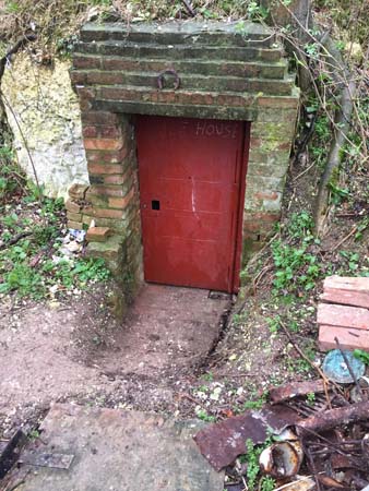
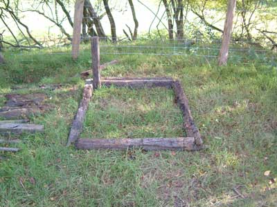
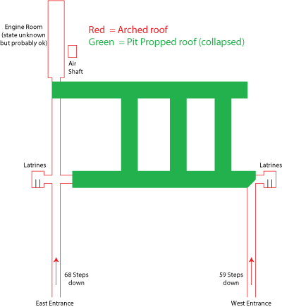
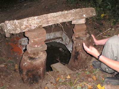
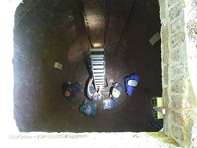
6th May The Canterbury Bunker is an old underground Brigade Command Center that was decommissioned around 1945. The owner had previously found and opened up the west entrance with the help of KURG and this return visit was to explore the newly opened up east entrance. When the first entrance was opened up, the passage having been completely sealed for many years, was full of bad air from rotting wood and had to be well ventilated before exploring was possible. The air in the east passage was well ventilated before we entered and presented no problems
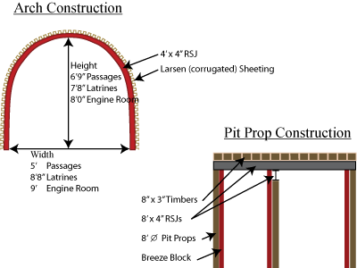
The west entrance, an opening near ground level, leads down a flight of 59 steps then along through an air lock. As can be seen in the diagrams to the right the tunnels were constructed using two methods and although all the tunnels using the arched RSJ and corrugated sheeting have survived virtually intact the tunnels using the pit prop method have collapsed and are totally inaccessible.
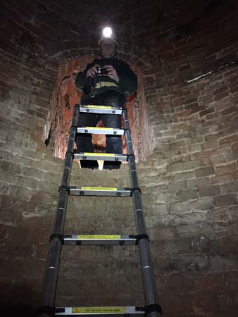
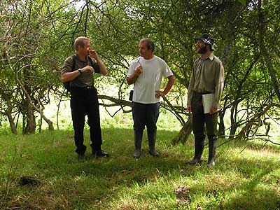
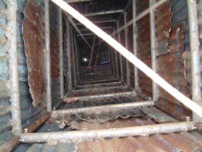
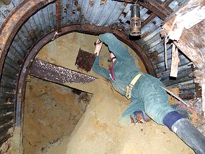
Hugh looking at the collapse in the east passage
The west passage was blocked after approximately 60’ where the arched roof stopped, but it was possible to enter the latrines on the right hand side after a little digging. The east entrance being slightly higher up has a flight of 66 steps down and can be entered to a length of 120‘. This is also blocked by a collapse where the arched roof stops. Half way along this passage a similar set of latrines can be entered on the left hand side and opposite this can be seen the collapsed passage connecting to the west entrance passage.
It was hoped it would be possible to enter the engine room beyond the end collapse but due to the fact there was a 12’ void above the collapse and the passages are dug in Thanet sand, its was decided this would be too dangerous, so no further exploration was possible.
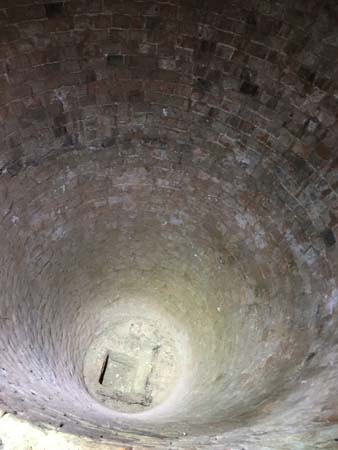
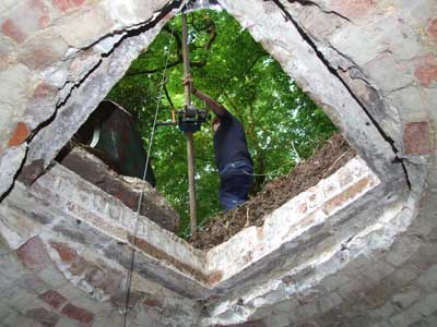
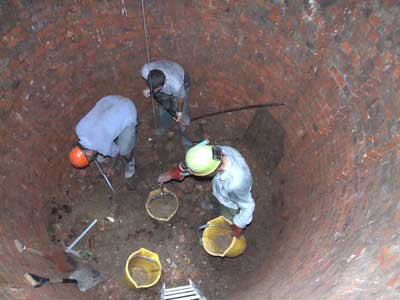
16th June After many years of being sealed up the concrete lid was raised on the old Ice House at Lullingstone.
22nd June Digging then began to clear out all the rubble and return the Ice House to it’s original state so it can be used by the local bat population
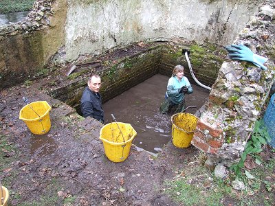
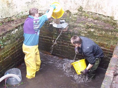
Winching out the buckets
Looking down into the Ice House
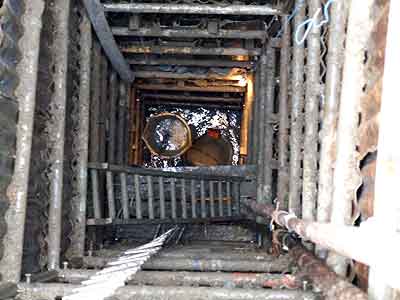
June 29th Further digging took place and the level has now fallen significantly inside.
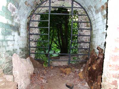
Fortunately the side entrance is well appointed and allows access without having to Descend / Ascend through the top.
Looking out of the side entrance
Nearly at the bottom !
June 29th More digging and hauling away of rubble.
After further digging the end is now in sight and will hopefully be reached during the next digging session.
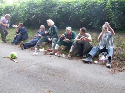
The digging crew having a break
Looking down at the bottom
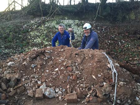
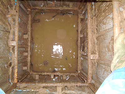
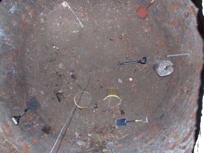
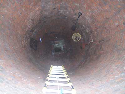
August 3rd After further digging during the intervening weeks, tonight we finished clearing all the remaining rubble from the Ice House.
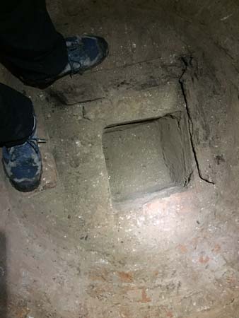
The whole chamber is now clear. The bottom is clearly visible and the whole chamber is remarkably well intact. The chamber is approx 19′ deep with a further 4′ deep drain hole / soakaway in the bottom.
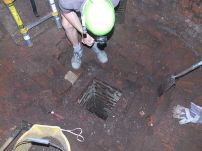
Looking into the drain hole
Installing the bat boxes.
Bat boxes have now been attached to the walls and all we can now do is wait and see if the bats will take up residence. During this visit we also had a look at the nearby bathhouse with a view to clearing the ivy off the outside and emptying the rubble out of it.
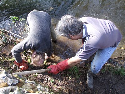
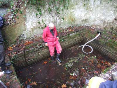
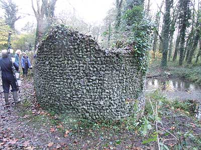
21st November Work started to look the the “bath house” although there are still conflicting ideas as to whether this is what it actually is. The pool itself was full of debris, probably from the crumbling walls and possibly a roof. There would appear to be a spring that feeds it, on the side furthest away from the river, with a constant source of fresh clean water.
Cleaning out the rubble
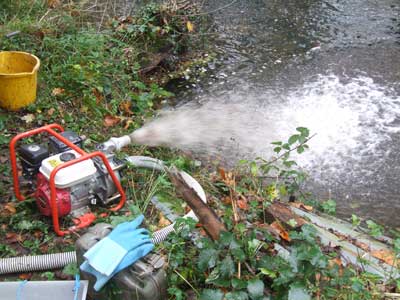
Pumping out.
Clearing ivy.
21st March 2010 Work continues on the “bath house”. Progress was hampered by the ability of the pump to keep up with the inflow of water. Initially this was thought to be entirely from the spring but further investigation revealed a link to the river. As fast as we were trying to empty it the river was refilling it. After digging an investigative hole and plugging the inflow we were able to drop the level significantly, especially with the aid if some manual bailing. Amongst the debris removed were some nice tiles, possibly from the bottom. Hopefully the next trip, when the river level is lower or we can use an additional pump, should see the task completed, and the bottom exposed.
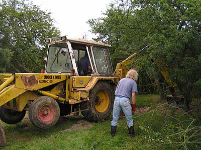
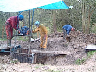
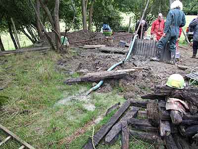
3rd July Initial dig by farmer using JCB. This reached down to about 8′. The remains of a previous exploration trench could clearly be seen cutting across the new one. We fenced off area to make it safe for cattle in field.
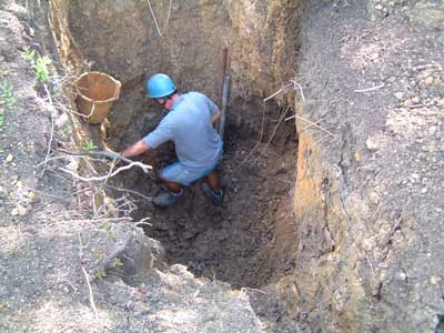
7th August We removed some slippage that had occurred since the last dig and explored the bottom of the hole to locate original shaft position. Temporary scaffolding was placed across the top of the hole to facilitate hauling and removal of infill. Work started to construct the ‘tower’ inside the hole. This is backed with corrugated steel sheeting cut to size and slipped (or bashed) behind the tower frame. The area around the shaft was started to be backfilled.
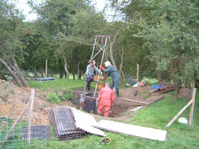
11th September A permanent frame was erected above the shaft to allow petrol driven winch to be installed. Work continued to dig and backfill the area around the shaft.
25th September Continued digging and backfilling area around shaft. Various pieces of wood from the original shaft were excavated.
9th October More digging and backfilling. Added another 5 feet to the depth of the shaft and passed through a layer of limestone which is clearly visible.
6th November We had to haul all the equipment down to the dig site in a wheelbarrow due to the very soft ground. Despite this and the wet weather we managed another 5 feet. The excavation is now in the original shaft cut through sandstone.
20th November The digging continued despite the freezing temperatures and the present depth is now 35 feet. The top has been extended and back filling is happening around this to make sure any surface water flows away from the shaft and not into it. Loads more wood from the original shaft has been recovered and the remains of the original timbers can now be seen in one corner the shaft
26th March The first dig of the new year saw us shuttering up the 9 foot of previously dug but un shuttered shaft. The weather was not very kind (it rained), but the farmer was and lent us his tractor to transport the shuttering and poles. At one point a gurgling sound from the bottom caused interest as all the water disappeared, but subsequent trampling in the bottom seems to have blocked it again.
3rd May Added about another 4 feet to the shaft and shuttered 3 feet. Although the weather was kind to us today, nice sunshine, were disappointed to see that water was entering near the bottom of the shaft and had formed quite a puddle by the time we left. Hopefully we have not hit the water table and this will have drained in time for the next dig. Still large amounts of old shuttering timber coming out, we have quite a pile now.
25th June Things don’t look too promising at the moment. Water is coming in to the shaft in one of the corners and seems to be settling at a constant level. Despite much prodding we couldn’t seem to replicate the gurgling we saw on the 26th March. When we left there was about 5 inches of water in the bottom of the shaft.
27th August Not much to report, more pumping, more digging, more water.
24th September Even with the pump running flat out the level of the water remained constant despite the dig continuing downward. By the end of the day the water was at thigh height.
8th October For the last push of the year we increased the pumping capacity by using a sump pump in the bottom of the shaft to pump the water up to the main lift pump. This necessitated having a generator on site as well as all the usual kit. Despite shifting about 60 gallons per minute we were still not making headway.
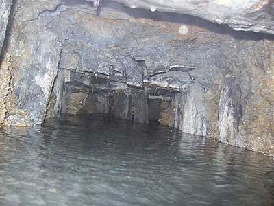
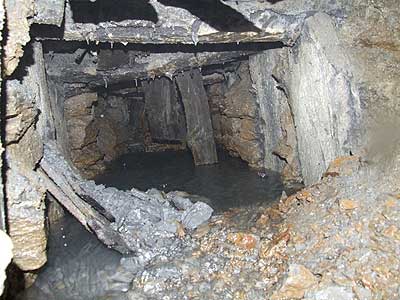
26th – 28th September 2008 After hiring a 3 phase pump the shaft was eventually pumped out and with a little digging the entrance to the mine workings were slowly exposed.
The workings could be clearly seen extending away from the shaft. The main route is in very poor condition and appears to be collapsed after a few meters. Side workings appear to have been worked out and bricked up. The workings are only visible with the pump running and quickly become submerged when the pump stops.
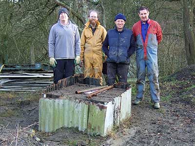
28th December 2009 This project has now been completed and no further exploration is anticipated in the foreseeable future. The final outing was to cap the shaft and tidy up the site. The water at the bottom of the shaft was at the highest level we have ever seen at 16.5ft. Together with a depth of 35ft to the surface of the water this gives a total shaft depth of 51.5ft.
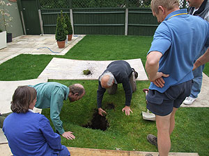
31st May 2008 A group of about a dozen of us attended a house in Gravesend where a mysterious hole had appeared in the garden
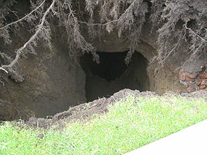
Following the recent bout of heavy rain the owner had noticed a dip in the back lawn of his property. After contacting the group we arranged to go and have a look. Initial inspection revealed a sagging area of grass with a small opening in the middle and a large void below. After a few minutes cutting away the overhanging grass a closer inspection revealed that the large void sloped downward into another hole with water at the bottom.
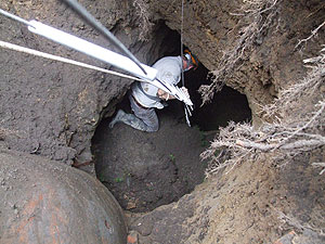
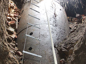
At this point we weren’t sure if it was a dene hole, mine or well. After securing a ladder and life line Pete was duly dispatched to investigate. Upon inspection it turned out to be a well which had obviously been capped at sometime in the past. The beehive shaped capping was in good order and had a pipe feeding into it having been used as a soak away at some point in the past.
It seems that water from a soak away, now clearly visible, installed a few years ago had found its way into the side of an old unknown and capped well. Over the ensuing years the water had slowly washed away the earth in its path. As more and more soil was washed away a growing void was being created under the lawn. Eventually during the recent heavy rain this void had completely collapsed revealing the well. We measured the depth to the bottom of the well to be about 11m and having stood in the water it turned out to be only about 3 feet deep. Obviously this would have been deeper before all the soil washed into it. The owner now plans to fill in both the well and hole. For more pictures click here.
 Manual bailing as pump couldn’t cope.